A city data platform built around what your local authority actually needs.
One shared platform, shaped with the first ten municipalities—from the base map to the people who live there.
CityMETER builds the local data foundation: community boundaries, roads, buildings, key places, population data, and the locations municipal teams rely on. CityChat brings that shared picture to frontline officers and people in the community, so everyone can see the same city and act from the same evidence. Each local authority begins with its own priority—not a preset menu.




For local authorities across Thailand · Fiscal Year 2026 (B.E. 2569)
Use CityMETER and CityChat free for one year, with support from depa.
Landometer Co., Ltd. is offering participating local authorities twelve months of access to its city data and disaster management platform at no cost—a package valued at more than THB 250,000.
- Program
- Cloud Infrastructure Enhancement for Local Smart Cities, Fiscal Year 2026 (B.E. 2569)
- Supported by
- Digital Economy Promotion Agency (depa)
- Eligibility
- Available to government agencies participating in the program through a digital provider registered with the Thailand Digital Catalog.

What your local authority receives over 12 months
Built around the priorities in the first four letters of intent.
- At least five GIS-based city datasets — digital community boundaries, transport networks, building footprints, key places, and population data.
- A City Dashboard for decision-makers — bringing data from multiple departments into one place for planning, budgeting, and targeted incident response.
- Geolocated household and vulnerable-population records — including older people, people with disabilities, and bedridden patients—so support and entitlements can reach them in time.
- Mapped risk locations and public reports, each with an owner and a trackable status.
- Staff training — at least one session for no fewer than 20 participants, so the team can work with and analyse the data independently.
Local authorities with signed letters of intent · Fiscal Year 2026
Four municipalities. Four priorities. One shared data foundation.
We are working through every requirement raised by the first ten local authorities to learn what a city data platform that truly fits Thai local government should look like. Each municipality starts with the same five core datasets, then builds around its own priorities.



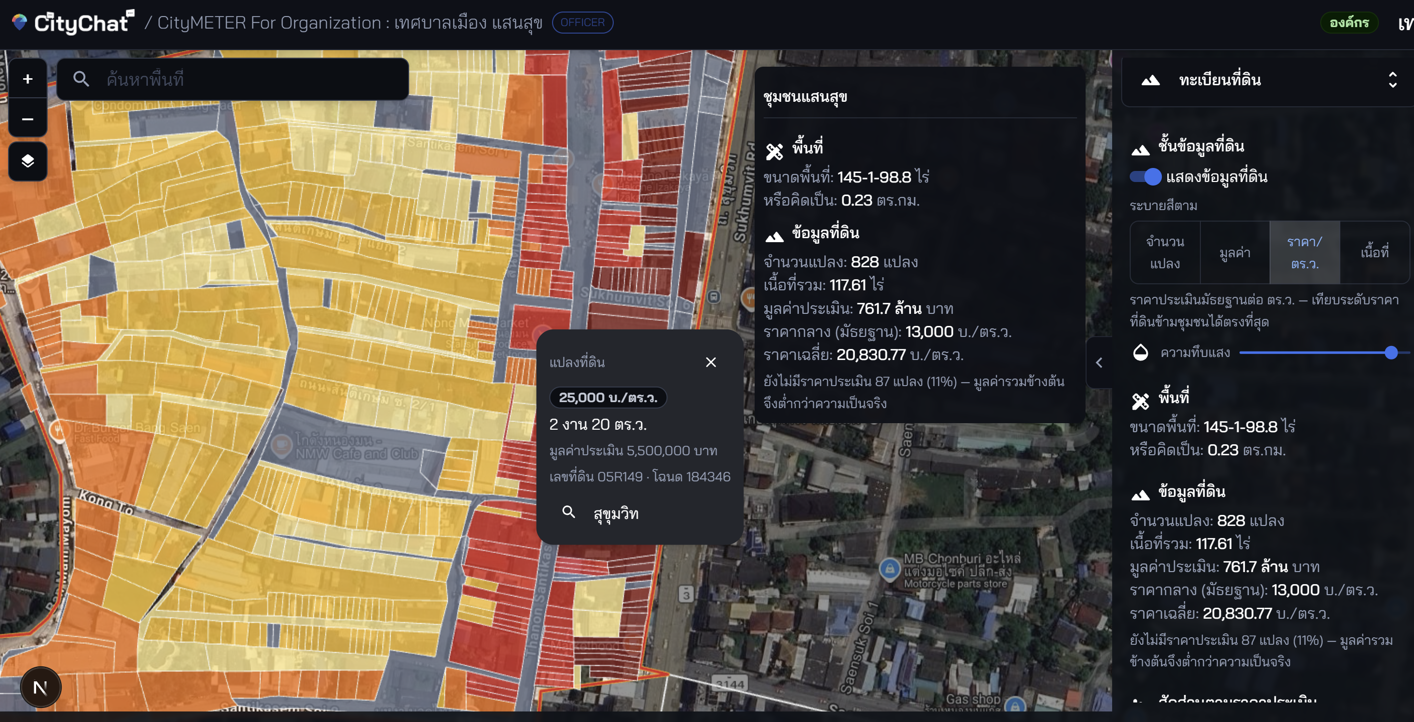
For municipal officers · CityMETER For Organization · A real system used by Saen Suk Town Municipality
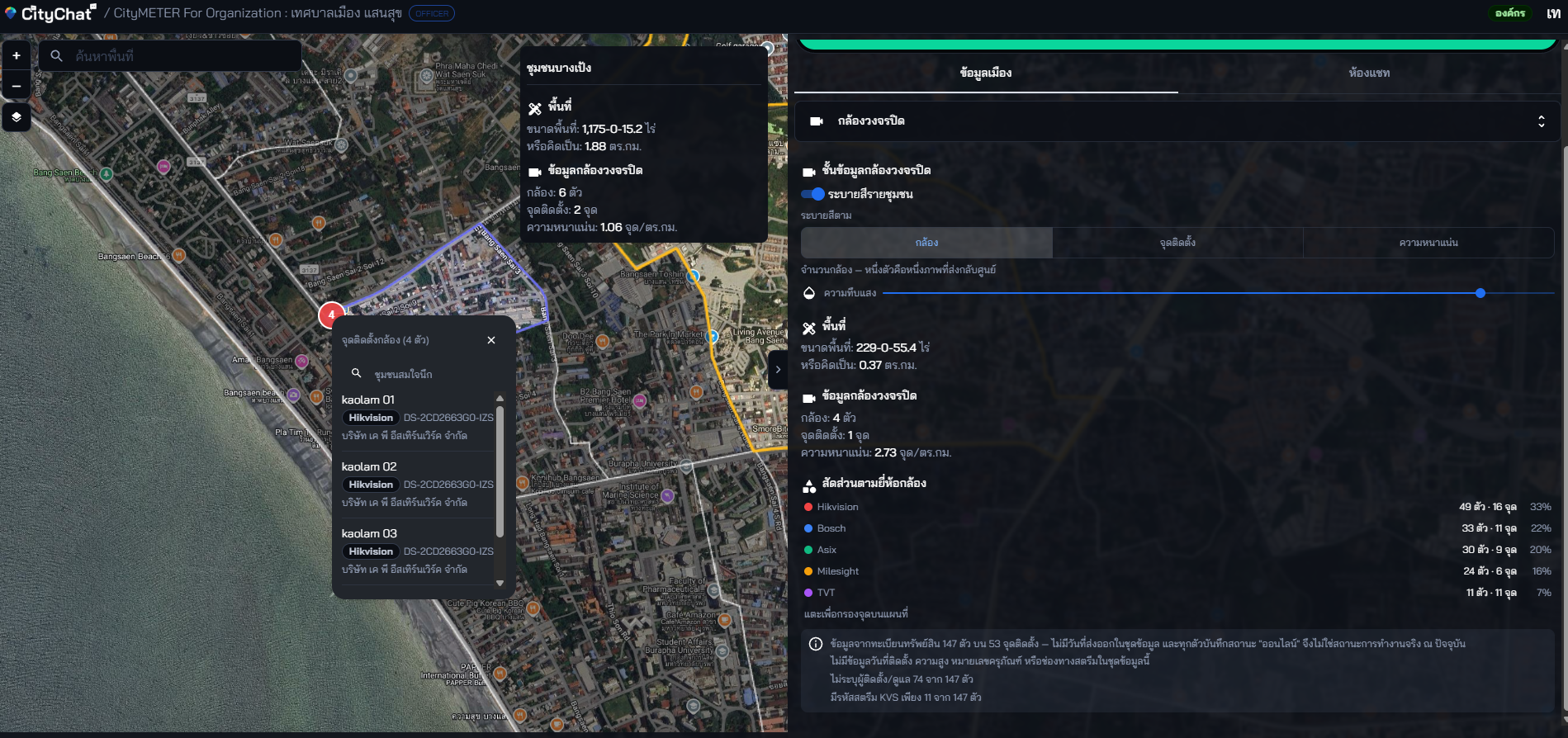
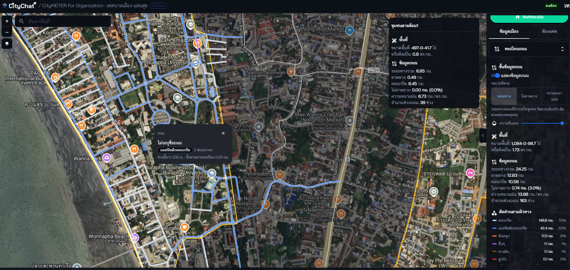
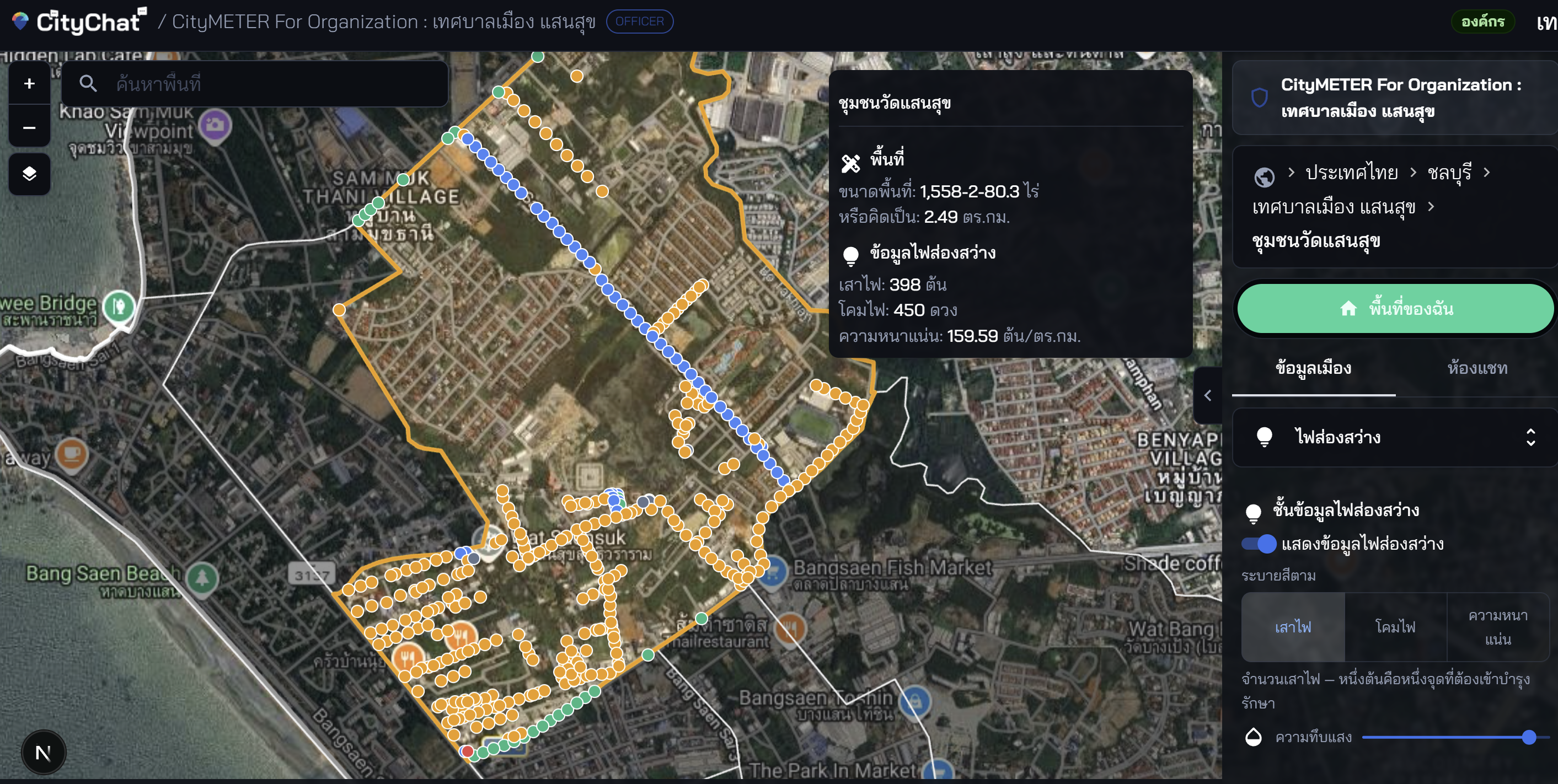
Inside the municipal workspace: city asset registers organised on a community map
Each layer can be read community by community—counts, density, and breakdowns by camera brand or road surface—with its source register, export date, and known limitations always visible.
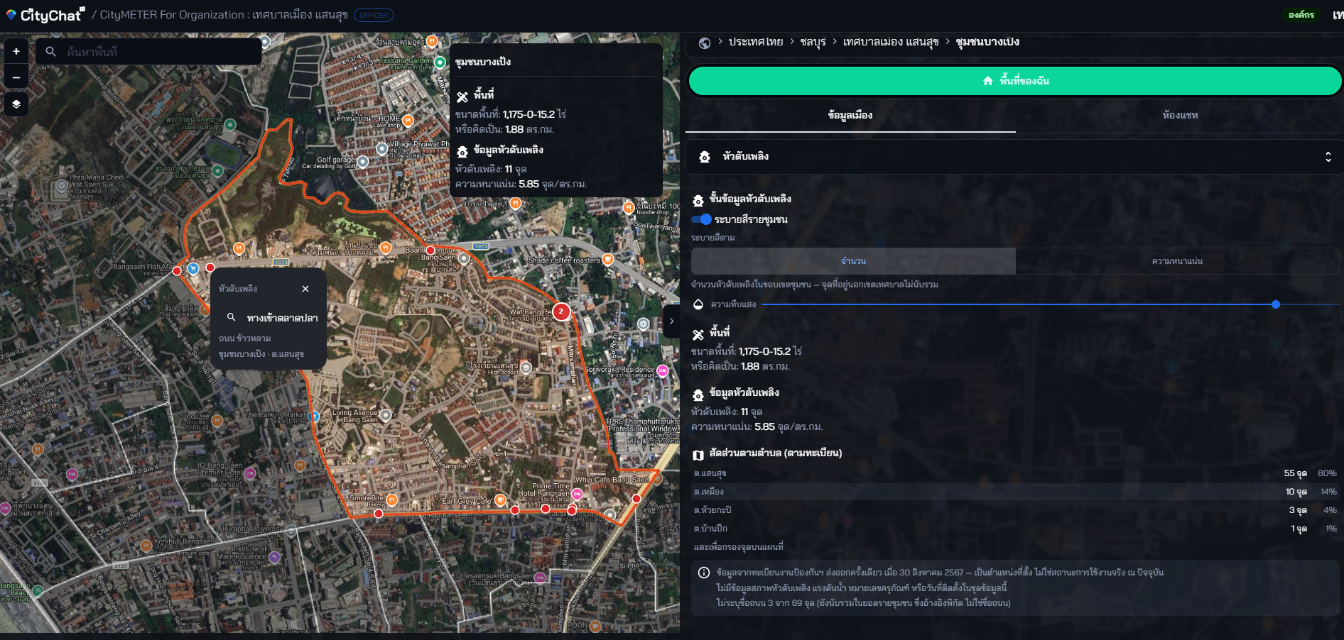
CityScan · Demo video
Capture conditions on the street. Keep the city register current.
CityScan is CityMETER’s field-survey workflow. As teams move through an area, it records the location and condition of city assets, then feeds that evidence into the same register officers use above—so local decisions do not stop at the date of the last data export.
When that evidence returns to the neighbourhood, CityChat opens with three grounded questions: what makes this place good to live in, worth visiting, and ready for local trade?
This browser cannot play the demo video.
Download the CityScan video (MP4)One city, two perspectives
Municipal staff do not simply need more data; they need data that helps them get work done. Residents do not only need a reporting channel; they need to see that their voice was heard and put to use. CityChat is designed for both groups, working from the same evidence.



Five things CityChat is designed to help with
See → Understand → Help answer → Move the work forward → See what changed and retain the learning. Every step begins with a real place and traceable evidence.
The city’s data and the community’s voice, side by side
One place can tell one coherent story: what signals are present, what the evidence does and does not show, what to ask next, and one practical action to take. Community voices sit alongside that story—clearly separated from official data and status, and never treated as less important.


Municipal Soi 12 · Past 90 days
After rain, this lane receives more reports of standing water than nearby lanes.
Four resident reports in 90 days. The data cannot yet tell us how long the water remains or which drainage point is causing it.
- Source
- 4 resident reports over 90 days · Updated 28 August 2026
- Scope
- Roads under municipal responsibility only
- Limitations
- Excludes drains managed by the Department of Highways and contains no measured water-level data.
- Owner
- Engineering Department · Received 29 August 2026
A question for people on this lane: Does the water recede within one hour after the rain stops?
Help answer this questionCommunity voices · Not an official status · Visible only to the reporter and responsible officers
The water still has not receded since this morning. Small cars cannot get through.
Reporter · 28 August 2026, 08:12
We’ve attached your message to this issue. The Engineering Department will inspect the drainage point today and report back here with what it finds.
Engineering Department officer · 28 August 2026, 09:40
Where local authorities chose to begin
The first four letters of intent share disaster preparedness as a starting point, but each municipality takes it in a different direction. Every topic has its own visual cue, always paired with a clear label—the image never replaces the words.